A forestry-mulching site assessment should establish what you want to keep, what you want to change and where equipment can work appropriately. Map the treatment boundary, desired vegetation, access, soil conditions, utilities, water features and expected finish before approving the scope. Acreage alone is not enough to plan the job.
The assessment is especially useful on mixed properties: an open field may connect to dense brush, a wooded bank and a drainage feature in a short distance. Treating that entire area as one uniform clearing job can leave important questions unresolved. This checklist focuses on decisions to make before forestry mulching, not instructions for operating equipment.
1. Define the finished use first
Write one sentence describing what success looks like. Examples include “make the existing access corridor visible again,” “reduce designated brush while retaining the marked trees,” or “prepare for a later landscape design.” These are illustrative goals, not interchangeable service packages.
Also state what success does not include. Unless explicitly contracted, vegetation treatment should not be assumed to include grading, stump excavation, debris haul-off, soil amendments, seeding or construction preparation. A cleared view is not proof that the ground is ready for a driveway or building.
2. Establish boundaries and keep areas
Use reliable boundary and easement information, and resolve uncertainty before cutting near a neighboring property. Mark the trees, planting areas and features that must remain using a convention the contractor understands. If neighboring trees lean into the work area, discuss that issue before mobilization rather than deciding during cutting.
NC State Extension recommends mapping woodland resources such as water features, access and management areas as part of planning. A practical project map can use separate markings for treatment zones, retained vegetation and exclusions. Keep a copy with the proposal so the crew and owner are referring to the same boundaries.
3. Describe the vegetation, not just its height
Photograph representative open growth, dense patches and the largest woody material from safe, accessible positions. Note known invasive plants, old cut stems and areas where vines obscure the ground. Identify species you want retained instead of labeling all understory as unwanted brush.
The U.S. Forest Service’s mastication guidance identifies invasive plants and site conditions as factors in deciding whether treatment fits. That supports a selective discussion: the right question is not simply whether a head can cut the material, but whether that treatment advances the property’s objective.
4. Review access from the road to the actual work
- Where can equipment unload without blocking traffic or routine property access?
- What are the gate widths and overhead obstructions?
- Are there narrow turns, culverts, septic areas or surfaces with uncertain load capacity?
- Will equipment have to cross an existing lawn, pavers or other finished areas?
- Can people, pets and vehicles be separated from active work?
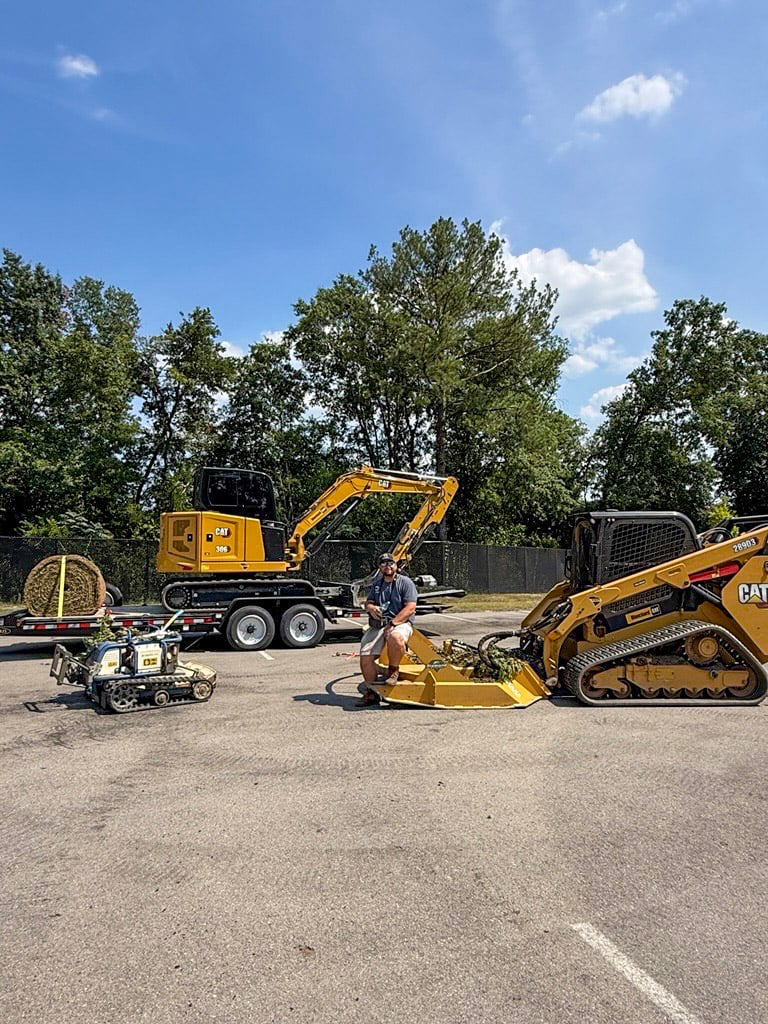
Share these details even if the treatment area itself looks open. Access constraints may affect the equipment selected, the portions that can be reached and the protection required for improvements. Do not assume a tracked machine can travel across every structure or soft spot.
5. Identify soil and terrain conditions
Tell the contractor where water lingers, vehicles have previously made ruts, fill has been placed or an edge appears unstable. Soil that looks dry at the surface may still need assessment before machinery enters. Steepness also needs consideration alongside transitions, obstacles and the space available to maneuver.
NC State Extension’s site-preparation guidance warns that heavy equipment on high-moisture soil can cause damage and that disturbance on steep slopes should be limited. The resulting work plan may include postponement or exclusion. No general slope capability should be inferred from the presence of tracks.
6. Flag water features and approval questions
Locate ponds, drainage swales, streams, wet areas, outlets and any known protected buffers. Review the property’s existing management or development plans. Vegetation beside a stormwater structure may have a maintenance function that differs from brush elsewhere on the parcel.
The South Carolina Forestry Commission’s BMP resources address water protection, streamside areas and forestry operations. Forestry guidance is not blanket authorization for residential development or land conversion. Where the project may affect a wetland, buffer, drainage system or regulated area, confirm the applicable requirements with the relevant local authority or qualified professional before treatment.
7. Locate utilities and disclose concealed hazards
List known lines, valves, wellheads, septic components, irrigation and abandoned fencing. Arrange utility coordination appropriate to the actual scope before any digging. SC811 explains that standard utility locating does not cover every private line; privately owned systems may need separate identification. North Carolina projects should use the corresponding state notification process.
Old wire, metal, dumped material and hidden masonry also deserve explicit discussion. The owner should not enter hazardous brush to conduct a do-it-yourself search. Agree on inspection, marking and removal responsibilities, including what happens if unexpected material is uncovered.
8. Agree on the finish and follow-up
Confirm the expected residue, acceptable remaining stems and treatment around retained trees. Note any follow-up inspection, vegetation management or planting work that is included; list separate work just as clearly. Take consistent before-and-after photos so the agreed result can be reviewed against the actual work area.
A useful assessment ends with fewer assumptions: defined zones, a realistic finish, clear exclusions and a plan for conditions that change. For related planning guidance, see preparing a difficult site for a contractor.
Send these details through ClearSlope’s free estimate form to discuss forestry mulching and bush hogging. You do not need to select the machine yourself; you do need to explain the property and the outcome.
Forestry Mulching Site Assessment FAQ
What should I send for a forestry-mulching estimate?
Provide the address, approximate treatment area, photos from accessible locations, gate or access details and a description of the intended finish. Include known fences, utilities, drainage features and trees or vegetation that must remain.
Do I need a survey before clearing?
Use reliable boundary information and resolve uncertainty before authorizing work near property lines or easements. A fence, an online parcel map or a mow line should not be assumed to establish the legal boundary. A surveyor can resolve boundary questions.
Should wet areas be included in the work area?
Show them to the contractor, but do not assume they can be treated. Soft ground, wetlands, stream buffers and stormwater features may require exclusions, another method or specialist review. The site’s applicable plans and approvals should be checked before work.
Does a utility locate identify every buried line?
No. Standard public utility locating may not identify privately owned lines, such as some irrigation, electrical or service lines beyond a meter. Identify private systems separately, and coordinate the appropriate 811 process before any digging or ground-disturbing work.
Should I remove hidden debris myself before the crew arrives?
Report suspected debris and mark known hazards only where this can be done safely. Do not enter dense growth, unstable ground or an active equipment area to search for material. Agree with the contractor on how inspection and removal will be handled.
Can the project proceed if part of the property is unsuitable?
Often the scope can be divided into approved work zones and exclusions. Suitable portions may be treated while wet, unstable, protected or unresolved areas are left alone. The proposal should clearly show that distinction rather than promising whole-site access.
Authoritative resources
NC State Extension: Woodscaping Your Woodlands U.S. Forest Service: Is Mastication Right for Your Site? NC State Extension: Site Preparation Methods and Contracts South Carolina Forestry Commission: Best Management Practices SC811: Homeowner FAQsExplore more property-care guidance in the ClearSlope Knowledge Center.
This guide provides general property-planning information. Site conditions, approved plans, manufacturer instructions, and applicable local requirements determine the appropriate scope. It is not a substitute for project-specific engineering or required inspections.